Special Price
$ 3.99 $ 23.00
Save 83% Today

Super Interactive Maps for WordPress

Last Update: November 6, 2025 5:56 AM
Sale!
Dont Miss The Chance

Product Overview

Quick highlights & key features

Experience blazing fast performance with our latest digital asset. Fully optimized, secure, and ready to elevate your workflow instantly.
100% Clean Code
Lifetime Updates
Secure & Verified
24/7 Support

Secure & Trusted

100% GPL Licensed
Latest Version
Unlimited Website Usage
Files Scanned & Verified
Secure Payment (SSL)
Instant Download
Trusted by 10,000+ Customers
24/7 Dedicated Support
Regular Automatic Updates

Why Buy From Pluginfy!

  • Very cheap price & Original product !
  • We Purchase And Download From Original Authors
  • You’ll Receive Untouched And Unmodified Files
  • 100% Clean Files & Free From Virus
  • Unlimited Domain Usage
  • Free New Version
  • Product Version : 2.4
  • Product Last Updated : 02.11.2025
  • License : GPL
If you opt for "Setup Required," our technical team will install the themes and plugins for you. For more information, you can contact us via chat.For web hosting and domain services, 👉 visit: www.hostfast.pk
Product total
Options total
Grand total
Quantity

    Fast Download

    4000+ Products

    Secure Transaction

    Virus Free

    24/7 Support

    Installation Guide
    1
    Download

    Download the plugin zip file from your account.

    2
    Upload

    Go to Plugins > Add New > Upload Plugin and upload the zip.

    3
    Install

    Click on Install Now and wait for the installation.

    4
    Activate

    Click on Activate Plugin to start using it on your website.

    5
    Configure

    Go to plugin settings and configure as per your need.

    Product Information

    Last Updated November 6, 2025
    Compatible WordPress 6.0+
    Requires PHP 7.4+
    Scanned by Norton
    License GPL
    Downloads 8,757

    Product Description

    Super Interactive Maps for WordPress

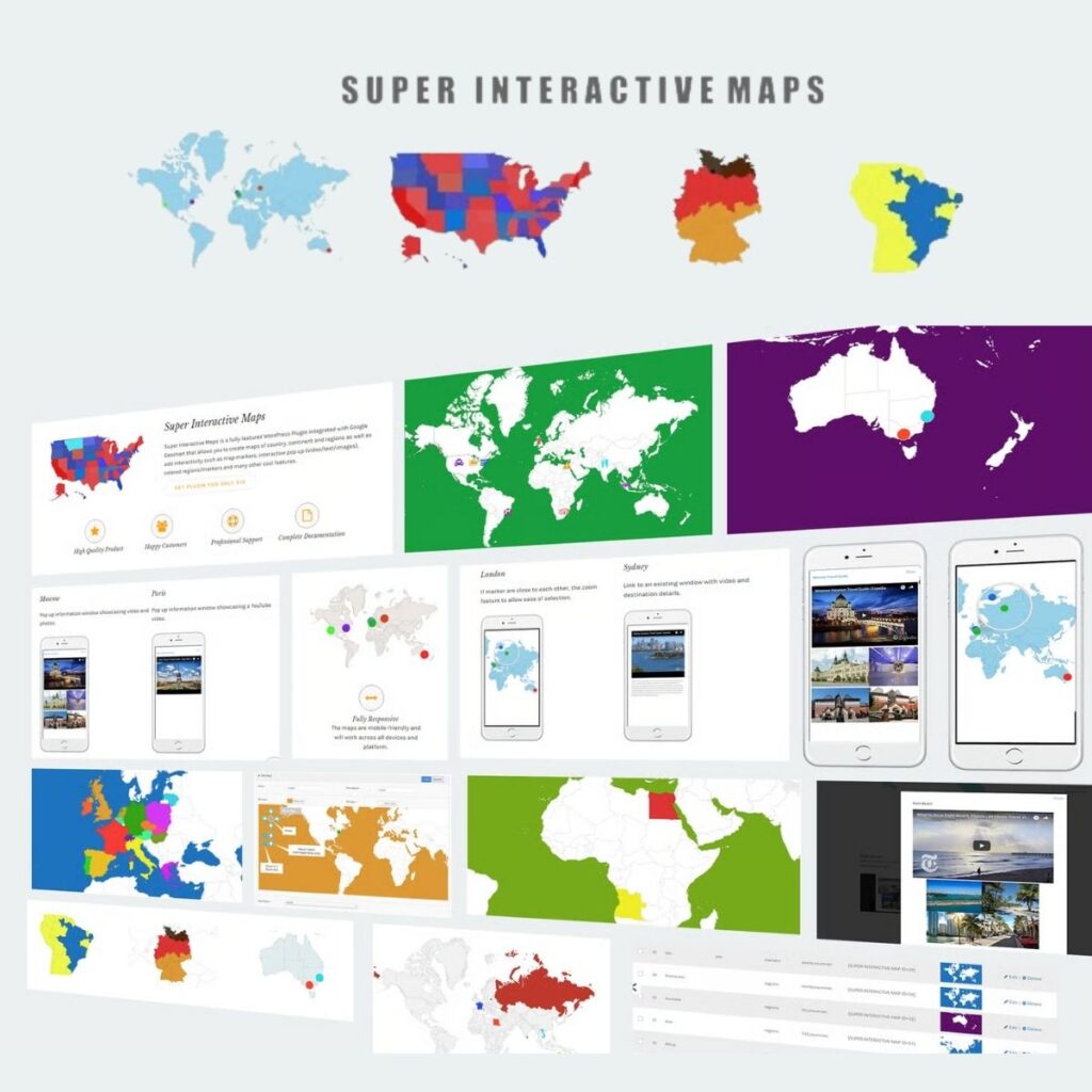
    Super Interactive Maps is a fully-featured WordPress Plugin integrated with Google Geochart API that allows you to create maps of country, continent and regions. Create custom markers on top of your map to show location of interest such as hotel, cafes, airport and others. You can add interactivity to your map such as displaying interactive tooltips, lightbox window or linking to a web page content.

    Main Features

    • Includes over 500 maps all in a one plugin (View All Country List and Provinces List)
    • All 195 countries world-wide included
    • Easily create SVG and vector maps on your WordPress site
    • Fully responsive and works on all mobile devices (cross device and browser compatible)
    • Vector Maps of World Map, Continent or Subcontinent including Africa, Europe, Asia, Oceania, Africa, South America, and Americas
    • Vector Maps of India, China, Turkey, Romania, Japan, Spain, Italy, France, Canada, Germany, UAE, Syria, Iceland, Poland, Malaysia, Australia, Mexico, Brazil, Indonesia, Nepal, UK, US, Russia and all countries included
    • Vector Maps of all countries divided by regions
    • Autocomplete Search to easily add locations
    • Pin point to the exact location using the drag and drop marker feature (Admin integrated with Google Maps API)
    • Customizable map designs, styles and colors
    • Choose your display styles (Regions, Markers or Text Labels)
    • Interactive responsive lightbox popup to showcase rich content such as text, images and videos
    • Add and customize interactive tooltips to maps
    • Zoom and Pan your map display
    • Display custom map markers on your map
    • Post shortcodes anywhere on your website including posts, pages and sidebar widgets

    Supported Maps:

    • World Maps
    • All Continent and Sub-continent including Africa, Europe, Americas, Asia and Oceania.
    • All Counties (All 195 countries in the world including USA, Brazil, United Kingdom, Australia, Canada, France, Germany Spain, Italy, Turkey, Singapore, Brazil, Chile, China, Japan, India, many more)
    • All Countries divided by regions
    • USA maps divided by state/region/city areas

    The maps design, styles and colors are fully customizable.